(this is the first of a two-part report on my visit to Morganza; the second part can be found here)
“If you want to explore the history of African American communities along the Mississippi River, the absolute best person to consult would be Ms. Kathe Hambrick.”
That’s what Ed Lyons said. Ed is a congregant in a congregation served by one of my colleagues – he put me in touch with Ed and Ed said get in touch with Kathy.
As soon as he said that she was the founder of the River Road African American Museum, I knew I recognized the name: I had already come across that museum in my internet searches. He suggested I reach out to her, either by email or phone. I tried email, which didn’t result in any response.
So, then I tried by phone (not my favorite, but if it works, you gotta work it). That did the trick.
Ms. Hambrick listened on the phone as I told her about the 1818 slave ring and the 137 African American women, children, and men stolen into permanent slavery, brought to New Orleans. I told her of the multi-racial group of people in New Jersey who had become stewards of this history. I told her of my upcoming trip to come to Louisiana to visit sites related to the Lost Souls story.
I told her that I hoped to visit the small town of Morganza because before it had been a plantation owned by Charles Morgan, one of the leaders in the slave ring. This was part of the pilgrimage: to go to the place which was the likely destination intended by the slave ring leaders and quite possibly where many of the Lost Souls ended up (though we do not actually know where they ended up – that part of the history has not yet been verified).
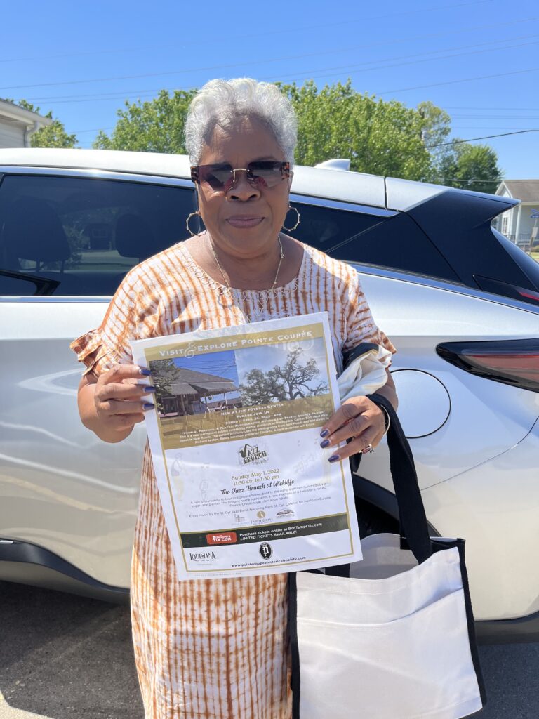
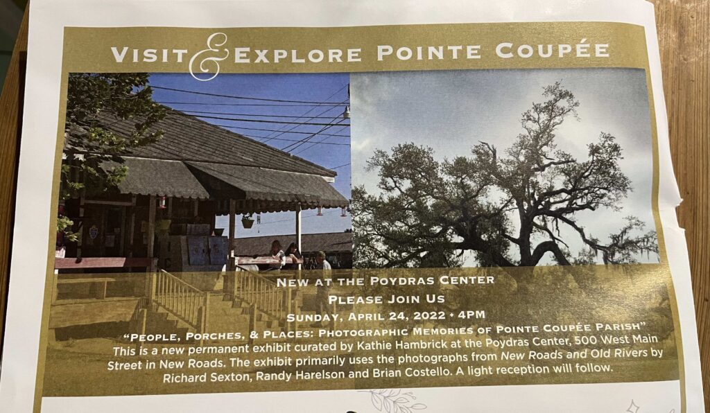
That first phone call was energetic. She shared about some of the work she had been doing, including the preservation of African American cemeteries that she and others are trying to save from being destroyed by the fossil fuel companies all along the Mississippi. I remembered then that I had read about her work not all that long ago. You can watch the amazing mini-documentary published in the New York Times in June, 2021, about the efforts of many community organizers to save these cemeteries. She has another upcoming event, a historical retrospective in photographs of Pointe Coupee Parish, is on April 24th:
Art. History. Preservation. Consulting. Design. Administration. She does it all. And no doubt more.
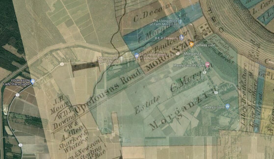
As I told her in that first phone call about my plans, she told me, unequivocally, that the absolute first thing I must do is create a map overlay.
a map overlay?
Not only did I not know how to do such a thing, I was not sure what it was. Ms. Hambrick explained: take two maps of the same place, but from different time periods, and overlay them. She suggested that it was essential to overlay the map of the plantation and a map of the town today, to be able to discern where the actual plantation property lay.
It was clear that Ms. Hambrick had a full calendar. It was also clear that she would have preferred that I had been in contact with her sooner. (In my defense, I did try but that email got lost in the ether.) Despite this preference, she worked wonders with her schedule. She texted me a few days later that she would be able to meet me in Morganza.
In the meantime, I reached out to my nephew, Sandy, and his partner, Gabriella, because they are Millennial urban planning geeks. I felt confident that if anyone in my circles could create a map overlay, it was them. Luckily, they agreed to try.
Ultimately, they created three versions, each with a different level of transparency – one with more of the 1858 map (thank you to several people to made sure I knew about this map, including Dr. Allison Bailey and Edwin Lyons) in the forefront, one with more of the 2022 map in the forefront. Here is one of the overlays:
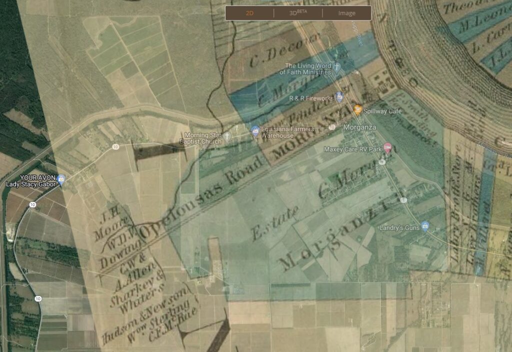
I’m thankful to Sandy & Gabriella, because having this map moved me out of the realm of metaphor into the realm of real. I could use this map and know, really and truly, whether I was walking on land that had been part of this particular slaver’s plantation and that was likely the same land that some of the Lost Souls, after having been kidnapped and stolen away, also walked.
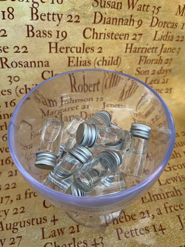
I emailed the overlay to Ms. Hambrick as she had requested. I had already told her that at each May, the Lost Souls Public Memorial Project recited the names of all the Lost Souls as part of embodying our stewardship of this history, as part of honoring these ancestors and their resilience. I shared with her that I hoped to recite some of the names of the Lost Souls on my visit to Morganza.
It was her idea to add to that a pouring of libation, which immediately sounded correct, especially since the suggestion came from her. A few weeks later, this suggestion sparked the idea to use homegrown holy water from my congregation and to seek additional blessings of members of the LSP, as well as people in my congregation.
Much of this journey has been like that: learn a new thing from someone else; apply it; and see new ideas and new connections spark and emerge.
Ms. Hambrick and I did end up meeting in Morganza. It was far better than anything I had imagined. I’ll have to leave that story for another post.